I was deciding on which cities I could do and I finally picked Singapore because it’s close to home and probably wouldn’t be as complicated as New York City or Tokyo. Second on the list was Prague but I did not want to deal with the Czech station names…
Work Flow:
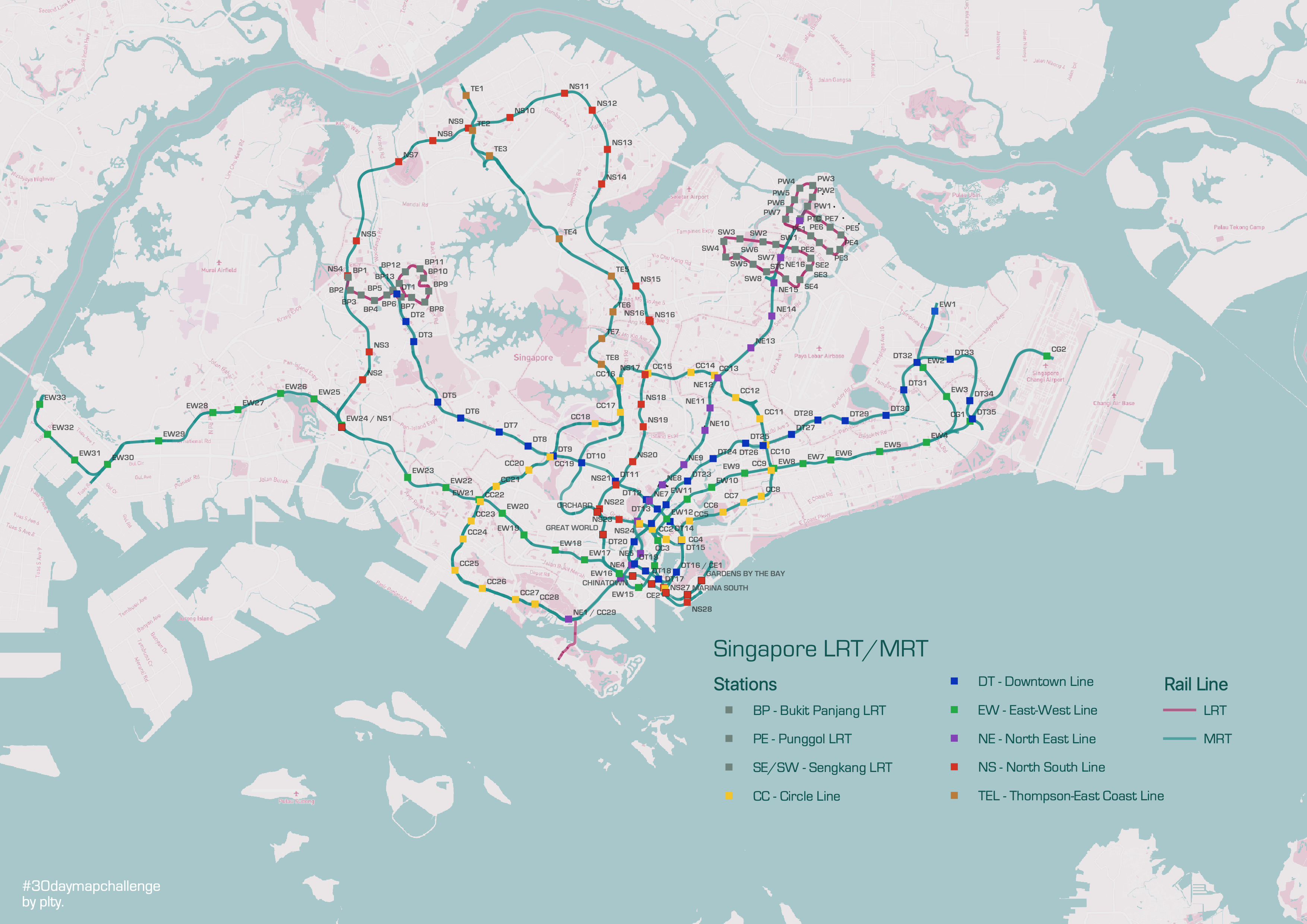
- Find data for lines and stations from data.gov.sg (ok, this site is super easy to navigate. gotta love Singaporean efficiency and organisation!)
- Import and clean up data – decided not to colour each line differently because this would’ve taken me FOREVER so I just categorised LRT vs. MRT and coloured the stations to match their line colour based on the SG government system map .
- Created a custom map from MapBox.com which I used a my base map and imported into qGIS with WMTS service. Adjusted the opacity and brightness to my liking.
- Created a legend – qGIS automatically vomits all the stations in the legend so I had to filter them out to show one point as a line instead
- Share!
pheebs
x
