I am skipping a post for Day 12 because I recycled the star map I made with Photoshop (below) that I’ve posted about before.

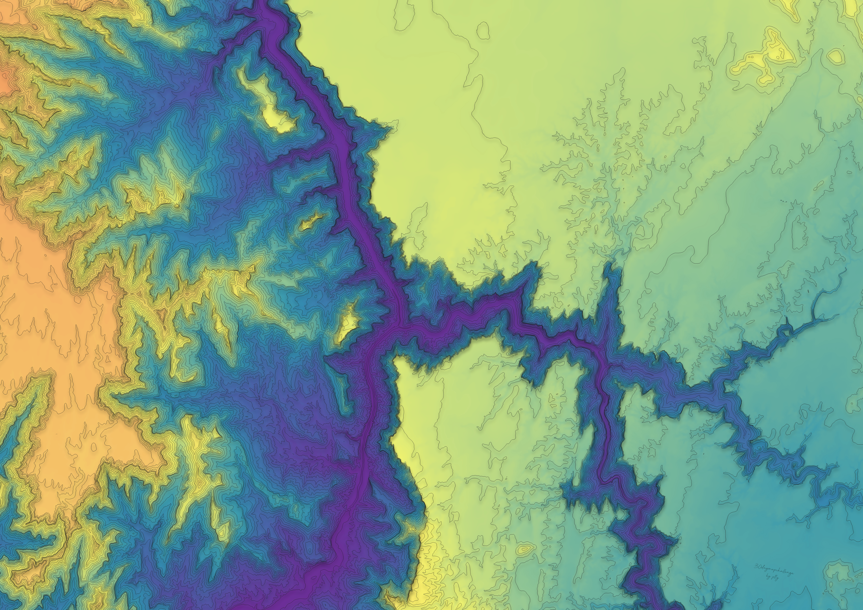
Yesterday, the 30 Day Map Challenge ended but I’m only posting about Day 13 over here. It’s alway a little harder to write about projects after you’ve already completed them awhile ago. Some details aren’t so fresh anymore. Anyways, for the theme “raster” I decided to make a contour map of Horseshoe Bend and its surrounding areas in Arizona/Utah. I was inspired by John Nelson’s Paper Cut Style. I played around with the colors until I was satisfied with how the rivers stood out. Since I’m using qGIS, it took more effort than just importing a style into ArcGIS Pro. I collected DEM data from USGS and here is the outcome!


pheebs
x
