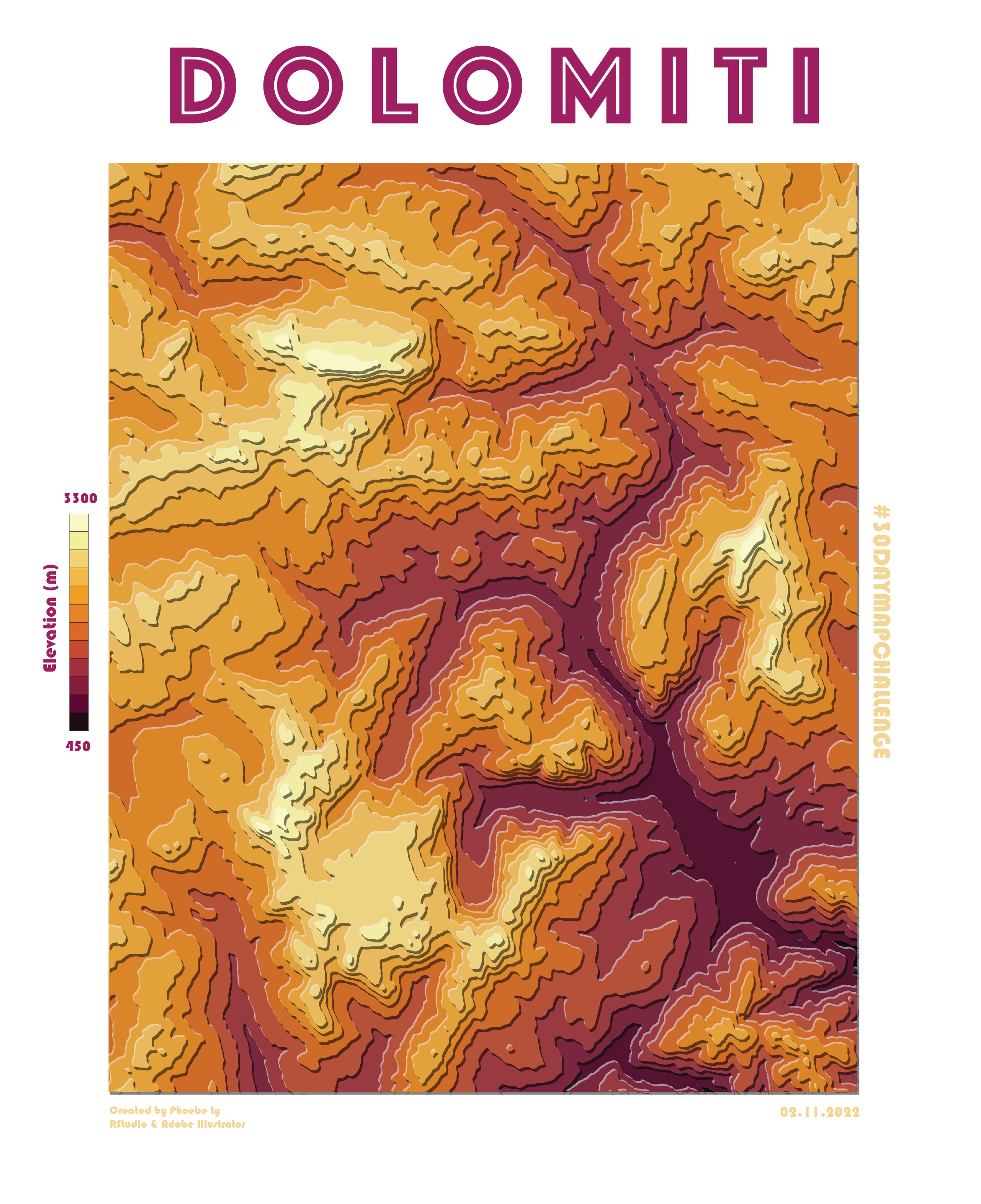
I finally started using R because of my classes in Geostatistics and I’m very happy about it. I’ve seen Tanaka contour map’s and just recently learned about it in my Cartographic Foundations class. I decided to finally make one. So, here is my first Tanaka contour map using R. This is a postcard style elevation map of Dolomite mountain area.
Tools: RStudio (tanaka, elevatr, terra packages), Adobe Illustrator.
Reference: https://github.com/riatelab/tanaka/blob/master/README.md
