Update: this map is featured in the Atlas of Design V7! It was also chosen for the Geohipster 2024 Calendar! You can find my map in September and the featured post on how I made the map.
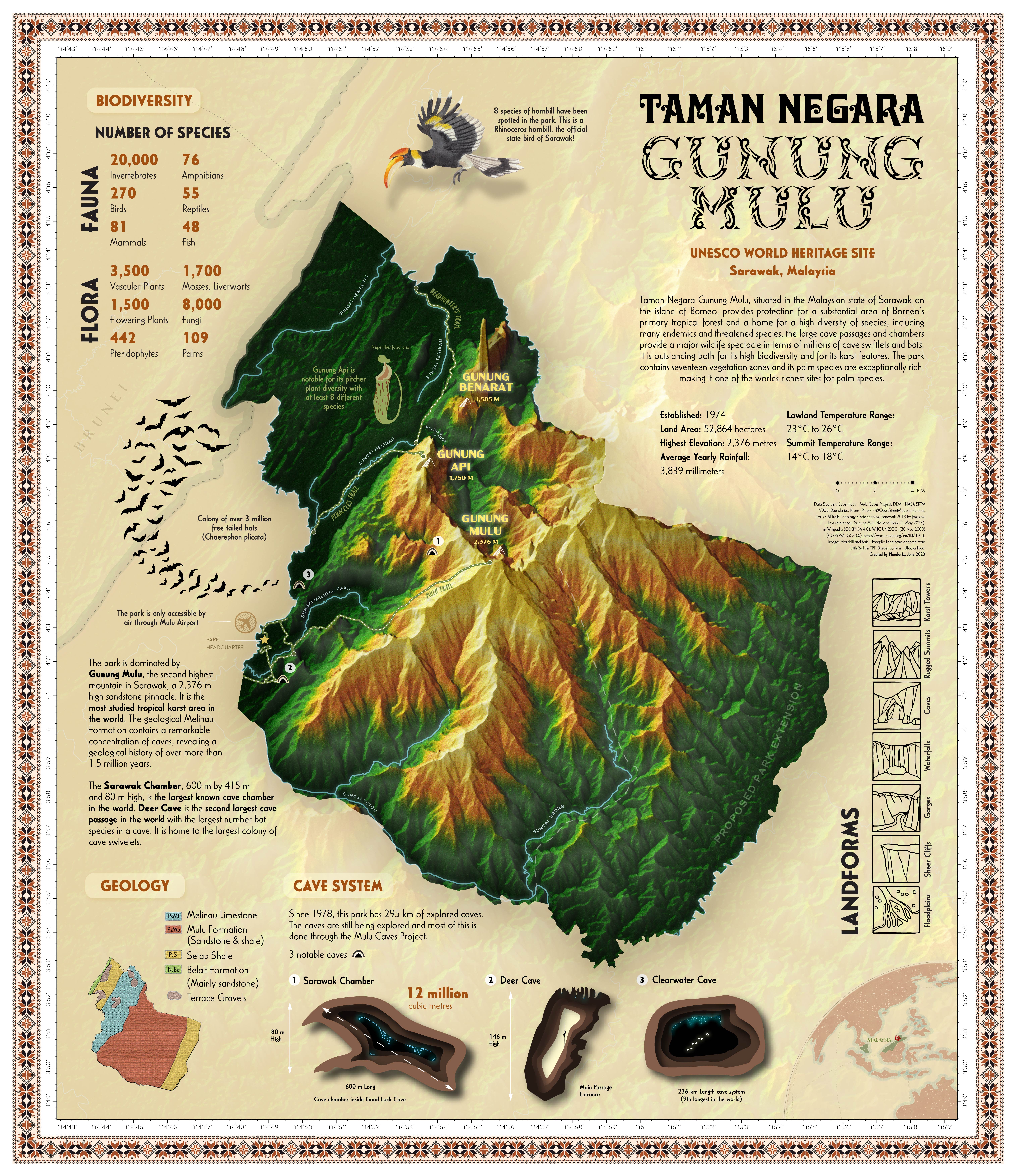


I am proud to present my first map designed for print, showcasing Taman Negara Gunung Mulu (Gunung Mulu National Park), a UNESCO World Heritage Site in Sarawak, Malaysia—my home country. This project is a tribute to its stunning beauty and biodiversity. While many beautiful maps focus on parks in North America and Europe, this map aims to educate the public about Taman Negara Gunung Mulu’s rich biodiversity and spectacular cave systems through a well-designed and easily comprehensible poster.
────୨ৎ────
How it was made
The map features a striking oblique view that captures the park’s mountainous terrain. It is so remote that the only access to the park is by flying into Mulu airport.
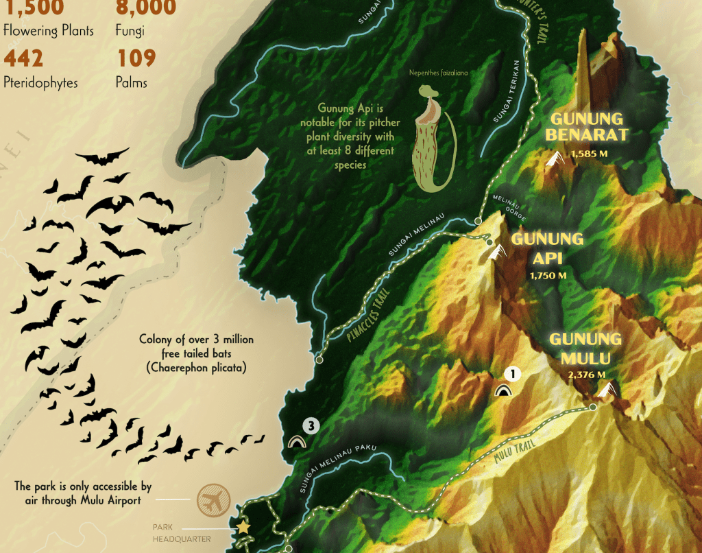
The base map was created using ArcGIS Pro with the plan oblique tool and overlaying multiple layers of DEM and hill shade. Despite limited geographic data due to Malaysia’s restricted open data resources, I utilized information from OpenStreetMap, All Trails, and the Mulu Caves Project to map major trails, rivers, caves, and mountains. A lot of time was spent making sure the polylines for the rivers, trails, and borders were topologically aligned.
This perspective offers a panoramic experience, enabling viewers to appreciate the park’s vastness in a print format. The design theme evokes a lush tropical forest, with a carefully selected color gradient to reflect the vibrant topography. Indigenous Sarawakian tribal aesthetics are incorporated through the map’s border, typography, and colors.
Although the map includes fewer geographic features, it is enriched with informative text and custom illustrations highlighting the park’s biodiversity, landforms, and geology. Balancing text and illustrations was crucial to ensure the information remains readable and engaging. I varied illustration styles and detail levels to make certain elements stand out while others blend seamlessly into the background.
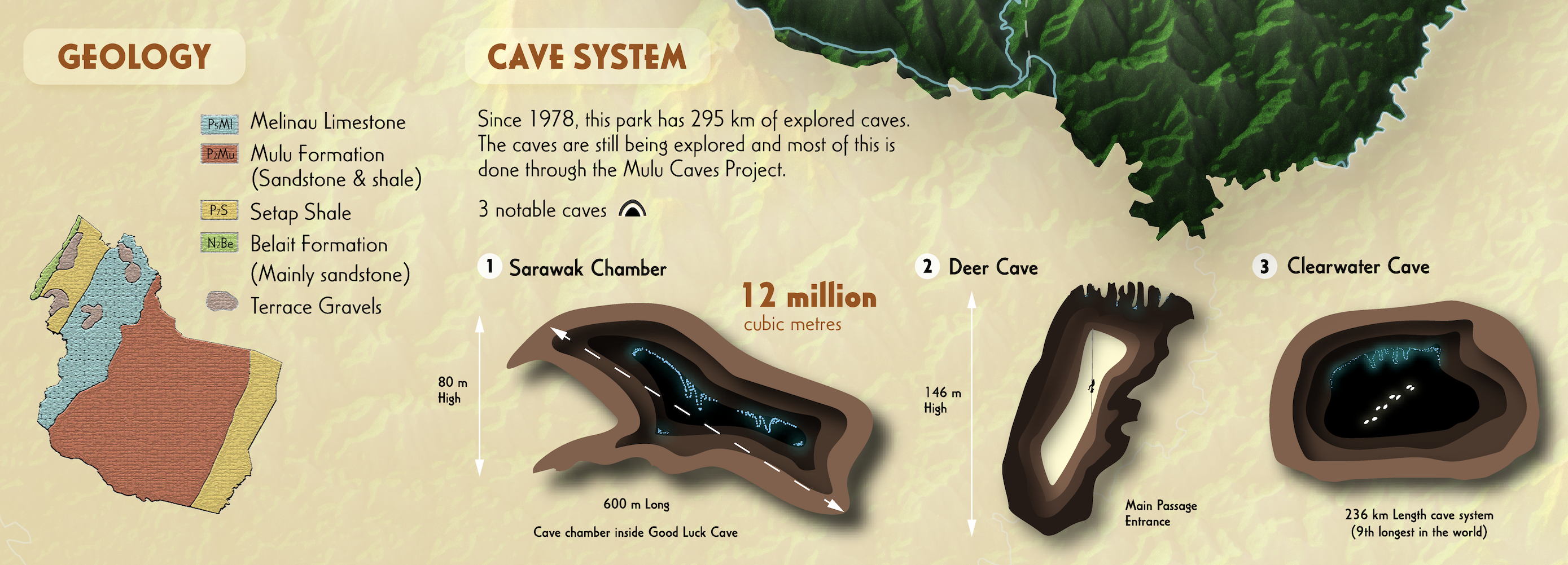
I decided to include a small map of the general geology to complement the terrain map and provide more insight into the area. For the caves, I wanted to highlight the three most notable caves, Sarawak Chamber (inside Good Luck Cave), Deer Cave, and Clearwater Cave. I made the illustrations of these caves using Adobe Illustrator based on real-life photos from Mulu Caves Project.


Choosing to map this national park for this project gave me the opportunity to learn more about this special place. This was my first ever map created for print. I loved working on it and I hope to make more printed maps in the future. For future work, I would like to create a map poster on the Mulu Cave Exploration expeditions and maybe even an online interactive map.
Tools: qGIS, ArcGIS Pro, Adobe Illustrator
Size: W514mm x H594mm
Sketches of Map Layout Ideas


