Mappy Munich is an online guide for tourists with limited mobility, that provides accessibility information for essential amenities and tourist attractions in the city center of Munich through interactive web maps.
For our mapping project this year, we were asked to create something related to accessibility. Before we began our group projects, our class made a visit to Pfennigparade in Munich to get to know the accessibility issues they faced by listening and asking questions. Our group decided to create something that could help with accessibility for people with limited mobility and to tie it in with tourism in Munich.

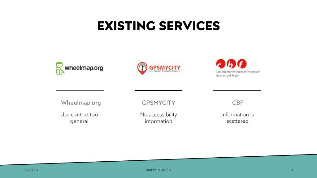
Existing Services & User Research:
During our research on existing services, we looked into tourism and/or accessibility websites and found that there were 3 which were closely related to our idea for Mappy Munich. However, there is a big element missing from each that we aim to fix with Mappy Munich.

During user research, we came up with a persona of someone with a disability visiting Munich and with their story in mind, created wireframes of our website using sketches and then a first prototype which we presented to our class and recevied feedback for.

This group project was the start of my discovery and fondness for front-end development and UI/UX design. Prior to this, I had beginner knowledge of CSS and HTML. During this project, I really dove into Javascript and used Mapbox GL JS for the web maps and interactivity. The website and design was built from scratch. As I was still learning, I tried to make the website as responsive as possible but it still needs more work on that end.
Overall, I was very proud of the work my group and I did!
For more information, you can view the official post about our project on the Cartography MSc website.
Please visit Mappy Munich to try it out!
Timeline: October 2022 – January 2022 (4 months)
My Role
- Website development and design
- Self-Guided City Tours web map application
- Data collection and processing for city tours
Tools Used
- Programming: Javascript, CSS, HTML
- Libraries: Mapbox GLJS
- Software: qGIS, Adobe Illustrator, Mapbox Studio
- GitHub
- Pen & paper for drafting a persona and wireframes

